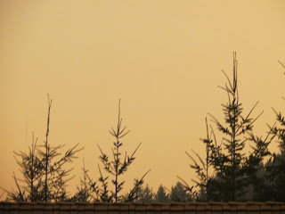
It continues to be a weird and scary time here in Oregon.
Monday evening most of the state was under a Red Flag warning with high temperatures, low humidity, and a vicious east wind.

That combination ignited dozens of fires across the state and sent them racing east down river valleys toward the Willamette Valley. Over 500,000 people have had to evacuate and several counties are in danger.
This is an evacuation map for the Holiday Farm Fire that began up the McKenzie River. It, like many of the fires, is ENORMOUS - now over 145,000 acres and totally uncontained. It moved east to the very edge of Springfield, Oregon and is now heading north from Lane County into Linn County. I live at the edge of the map below the words "Amazon". The skies are yellow and orange, the air quality is hazardous. This is scary, scary, scary. Unlike anything I've ever experienced as a native Oregonian.


6 comments:
Beth, please be safe. I have been praying for everyone in the West who are dealing with the fires (either directly or indirectly). And will continue to do so. Thinking of you.
Who started the fire should be shot. Look at the damage that is being done. I hope you stay safe and out of the fire. Hugs Lynda Ruth
Sending prayers Beth. We're getting a lot of ash here in the south bay. And the sky us not unlike yours, only slightly better.
This is terrifying and heartbreaking. What a tragedy for all living things in the fire's path. Please stay safe, Beth.
I have been so worried about you and so many people. We have had a day of twilight . It has been about 8 pm all day. I am praying for everyone and hope we get the rain soon. Be safe Beth!
Stay safe, please! And may all your wild animals and plants and birds and everything be safe as well.
Post a Comment